Clark‘s small group walks several miles along the beach to reach the Salt Works at present Seaside, Oregon. From there, they climb up and over the very “Pe Shack” (bad) Tillamook Head—Clark’s Mountain.
Lewis and most of the enlisted men continue their daily routine at Fort Clatsop.
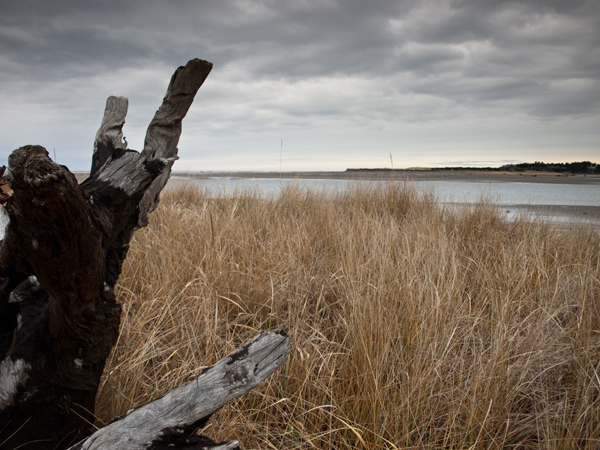
Necanicum River Mouth (view northwest)
© 19 December 2010 by Kristopher K. Townsend. Permission to use granted under the Creative Commons Attribution-Share Alike 4.0 International license.
Necanicum Clatsop Village
we proceeded on the Sandy beech nearly South for 3 miles to the mouth of butifull river with bold and rapid Current of 85 yards wide and 3 feet deep in the Shallowest place, a Short distance up this river on the N E Side is the remains of an old village of Clatsops. I entered a house where I found a Man 2 Womn & 3 Children, they appeared retchedly pore & dirty, I hired the man to Set us across the River which I call after the Nation Clat Sop river for which I gave 2 fishing hooks—
—William Clark
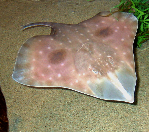
Big Skate, Raja binoculata
© 2007 by Valerie Mayers. Permission granted under the Creative Commons Attribution 2.0 Generic license.
A Singular Species of Fish
in walking on the Sand after crossing the river I Saw a Singular Species of fish which I had never before Seen one of the men Call this fish a Skaite, it is properly a Thornback.
—William Clark
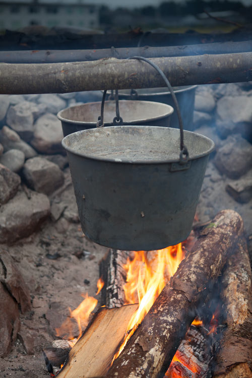
Salt Makers (recreation)
Presentation by the Pacific Northwest Living Historians. Photo © 2013 by Kristopher K. Townsend. Permission to use granted under the Creative Commons Attribution-Share Alike 4.0 International license.
Salt Makers’ Camp
the Salt makers had made a neet Close Camp, Convenient to wood Salt water and the fresh water of the Clât Slop river which at this place was within 100 paces of the Ocian they wer also Situated near 4 houses of Clatsops & Killamox, who they informed me had been verry kind and attentive to them.
—William Clark
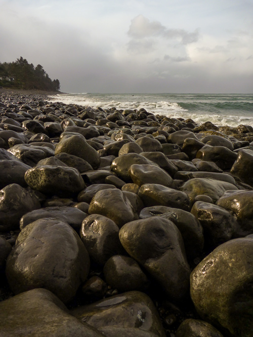
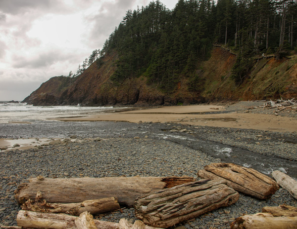
Slippery Stones Under Tillamook Head
© 20 December 2010 by Kristopher K. Townsend. Permission to use granted under the Creative Commons Attribution-Share Alike 4.0 International license.
Slippery Stones
we proceeded on the round Slipery Stones under a high hill which projected into the ocian about 4 miles further than the direction of the Coast. after walking for 2½ miles on the Stones my guide made a Sudin halt, pointed to the top of the mountain and uttered the word Pe Shack which means bad, and made Signs that we could not proceed any further on the rocks, but must pass over that mountain
—William Clark
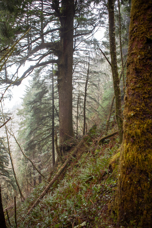
Northern Slope of Tillamook Head
© 28 March 2012 by Kristopher K. Townsend. Permission to use granted under the Creative Commons Attribution-Share Alike 4.0 International license.
Clark’s Hesitation
I hesitated a moment & view this emence mountain the top of which was obscured in the clouds, and the assent appeard, to be almost perpindecular; as the Small Indian parth allong which they had brought emence loads but a fiew hours before, led up this mountain and appeared to assend in a Sideling direction, I thought more than probable that the assent might be torerably easy and therefore proceeded on, I soon found that the [blank] become much worst as I assended, and at one place we were obliged to Support and draw our Selves up by the bushes & roots for near 100 feet,
—William Clark
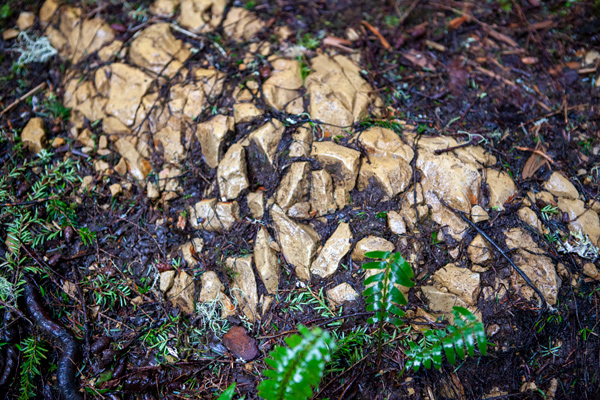
White Rock on Tillamook Head Trail
© 28 March 2012 by Kristopher K. Townsend. Permission to use granted under the Creative Commons Attribution-Share Alike 4.0 International license.
White Strata
In the face of this tremendeous precipic imediately below us, there is a Strater of white earth (which my guide informed me) the neighbouring indians use to paint themselves, and which appears to me to resemble the earth of which the French Porcelain is made; I am confident that this earth Contains argill, but whether it also Contains Silex or magnesia, or either of those earths in a proper perpotion I am unable to deturmine.
—William Clark
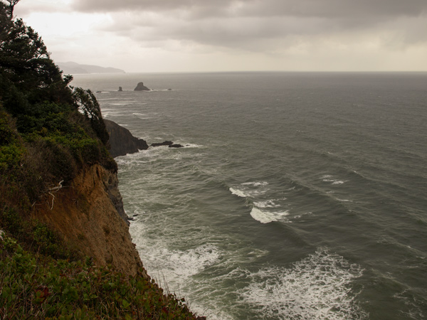
View from Tillamook Head
© 31 March 2009 by Kristopher K. Townsend. Permission to use granted under the Creative Commons Attribution-Share Alike 4.0 International license.
Atop Clark’s Mountain
after about 2 hours labour and fatigue we reached the top of this high mountain, from the top of which I looked down with estonishment to behold the hight which we had assended, which appeared to be 10 or 12 hundred feet up a mountain which appeared to be almost perpindicular, here we met 14 Indians men and women loaded with the oil & Blubber of the whale.
—William Clark
Canyon Creek Meets the Ocean
© 31 March 2009 by Kristopher K. Townsend. Permission to use granted under the Creative Commons Attribution-Share Alike 4.0 International license.
Much Fatigued
proceeded on a bad road and encamped on a Small run passing to the left. all much fatiagued
—William Clark
Weather Diary
aspect of the weather at rise
Wind at rise
Weather at 4 OC. P.M. Wind at 4 OC. P.M. fair N. E. cloudy after fair S E it clouded up just about sunset, but shortly after became fare.
—William Clark[1]To assist the reader, the editor of this web page has omitted the “Day of the month” column and spelled out some abbreviations.
Experience the Lewis and Clark Trail
The Lewis and Clark Trail Experience—our sister site at lewisandclark.travel—connects the world to people and places on the Lewis and Clark Trail.
Plan a trip related to January 7, 1806:

Fort Clatsop is a High Potential Historic Site along the Lewis and Clark National Historic Trail managed by the U.S. National Park Service. The site is managed by the Lewis and Clark National and State Historic Parks.
Notes
| ↑1 | To assist the reader, the editor of this web page has omitted the “Day of the month” column and spelled out some abbreviations. |
|---|
