At Wood River, Clark reports “nothing remarkable to day” other than two deer are killed.
Elsewhere, Lewis updates Thomas Jefferson as to his progress gathering intelligence in Cahokia and St. Louis: a census of Louisiana and journals and maps from explorers John Evans and James Mackay.
John Evans’ Map Sheet 6
To see modern labels, point to the map.
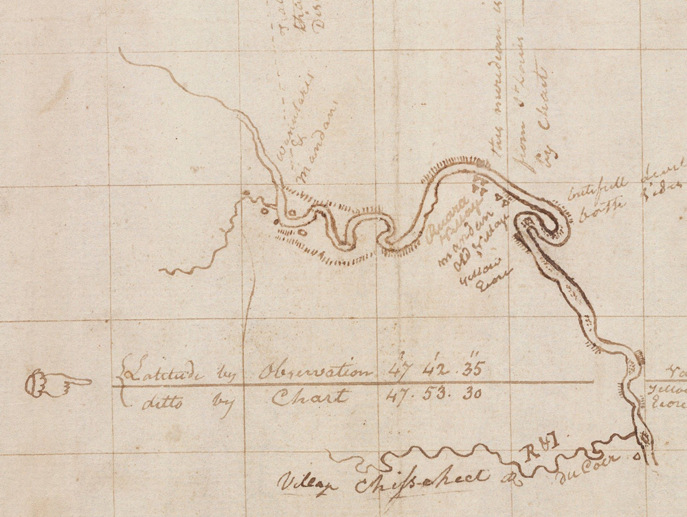
Courtesy Beinecke Rare Book and Manuscript Library, Yale University, collections.library.yale.edu/catalog/2002449.
Mackay and Evans Journals
Cahokia December 28th 1803.
Dear Sir [Thomas Jefferson],
I have also obtained Ivins’s and Mac Kay’s journal up the Missouri, it is in French & is at present in the hands of Mr. Hay, who has promised to translate it for me; I am also promised by Mr. Hay copy of his journal from Michilimackinack to the Assinaboin river in the north
MERIWETHER LEWIS. CAPT.
1st. U.S. Regt. Infty.[1]Lewis to Jefferson. Donald Jackson, ed. Letters of the Lewis and Clark Expedition with Related Documents: 1783-1854, 2nd ed. (Urbana: University of Illinois Press, 1978), 155.
Three Louisiana Maps
Cahokia December 28th 1803.
Dear Sir,
I have obtained three maps; one of the Osages river, before mentioned, a general map of Uper Louisiana, and a map of the Missouri river, from it’s mouth to the Mandane [Mandan] nation
MERIWETHER LEWIS. CAPT.
1st. U.S. Regt. Infty.[2]Lewis to Jefferson, Jackson, Letters , 155.
Taking a Census
Cahokia December 28th 1803.[3]Lewis’s meeting with Soulard occurred between December 10 and 28. During this period, Lewis traveled between Cahokia and St. Louis.
Dear Sir,
He [Antoine Soulard] told me he thought I might state the present population of Uper Louisiana in round numbers at 10,000 souls, 2,000 of whom were slaves & people of colour, and of the remaining 8,000, two thirds of them at least were emigrants from the U’States; that the remaining third, were either French or Canadian descendants, the Spaniards and their descendants being so few in number, that deserved no particular notice as a class of people.
MERIWETHER LEWIS. CAPT.
1st. U.S. Regt. Infty.[4]Lewis to Jefferson, Jackson, Letters , 150.
Nothing Remarkable Today
a Cloudy day no Ice in the river, nothing remarkable to day— Drewyer Kill a Deer & the Indn Kill another
—William Clark
Experience the Lewis and Clark Trail
The Lewis and Clark Trail Experience—our sister site at lewisandclark.travel—connects the world to people and places on the Lewis and Clark Trail.
Plan a trip related to December 28, 1803:


Winter Camp at Wood River (Camp Dubois) is a High Potential Historic Site along the Lewis and Clark National Historic Trail managed by the U.S. National Park Service. The site, near Hartford, Illinois, is managed as Lewis and Clark State Historic Site and is open to the public.
Notes
| ↑1 | Lewis to Jefferson. Donald Jackson, ed. Letters of the Lewis and Clark Expedition with Related Documents: 1783-1854, 2nd ed. (Urbana: University of Illinois Press, 1978), 155. |
|---|---|
| ↑2 | Lewis to Jefferson, Jackson, Letters , 155. |
| ↑3 | Lewis’s meeting with Soulard occurred between December 10 and 28. During this period, Lewis traveled between Cahokia and St. Louis. |
| ↑4 | Lewis to Jefferson, Jackson, Letters , 150. |